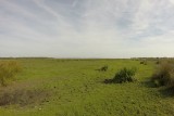
The shores of La Brière marshes - Les bords de Brière
 ,
,  Itinéraire VTC ou VTT
 Départ : Eglise de Pompas
 Arrivée : Eglise de Pompas

 Departure/Arrival
 Point of interest
- Useful Information :
") Average duration (based on a speed of 4km/hour) 2h45
Average duration (based on a speed of 4km/hour) 2h45 Distance in kilometres 11.4 km
 Point of departure/place of departure Eglise de Pompas
 Point of arrival/place of arrival Eglise de Pompas
 access Depuis Herbignac, prendre dir. Guérande via D774 puis à droite dir. Pompas (D83)
 Marked trail Jaune